 Numerous
caves and rock outcroppings surround this village, whose name can be translated
as "ravine land". The spurs of the Great Caucasus Range descend to the
Caspian along the Djeirankechmez river.
Numerous
caves and rock outcroppings surround this village, whose name can be translated
as "ravine land". The spurs of the Great Caucasus Range descend to the
Caspian along the Djeirankechmez river.
Settled since the 8th millennium BC, the area contains thousands of rock engravings spread over 100 square km depicting hunting scenes, people, ships, constellations, animals, etc. Gobustan's consecration in the world stage arrived in 2007, when UNESCO included the 'Gobustan Rock Art Cultural Landscape' in the World Heritage list.
 The
oldest petroglyphs date from the 12th century BC. Later, the European invaders
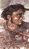
also left their marks: inscriptions left by Alexander the Great's
cohorts in the 4th century BC and 2,000-year-old graffiti written by Trajan's
Roman
legionnaires! Should you want to get the perfect photos as seen on the
postcards, the trick is simple: fill the carvings with toothpaste.
The
oldest petroglyphs date from the 12th century BC. Later, the European invaders
also left their marks: inscriptions left by Alexander the Great's
cohorts in the 4th century BC and 2,000-year-old graffiti written by Trajan's
Roman
legionnaires! Should you want to get the perfect photos as seen on the
postcards, the trick is simple: fill the carvings with toothpaste.
The petroglyphs of Gobustan were discovered accidentally by quarry workers only in the 1930s. In addition to the rock carvings, traces of Mesolithic period occupation are to be seen, with numerous burial mounds and graves, the most interesting at Firuz, where eleven skeletons were found. Don't miss the Gaval-Dashy, a resonant stone that rings like a gong when struck.
 The
local museum adjacent to the site houses the ornaments, flints,
shells, ceramics, beads and primitive tools that were found inside the
caves - often objects of non Caspian origin, evidence of ancient links
with Europe and the Indian sub-continent. At the museum you can also recruit
the services of a guide.
The
local museum adjacent to the site houses the ornaments, flints,
shells, ceramics, beads and primitive tools that were found inside the
caves - often objects of non Caspian origin, evidence of ancient links
with Europe and the Indian sub-continent. At the museum you can also recruit
the services of a guide.
 Based
on the archeological finds and on content of the petroglyphs, recently
it has be theorized that a connection exists between the ancient Azeris
and the peoples of Scandinavia, which is not surprising at all, since some
of the original habitants of the region, the Medes, were not a Turkic people,
but an Indo-European people.
Based
on the archeological finds and on content of the petroglyphs, recently
it has be theorized that a connection exists between the ancient Azeris
and the peoples of Scandinavia, which is not surprising at all, since some
of the original habitants of the region, the Medes, were not a Turkic people,
but an Indo-European people.
Besides being famous for the petroglyphs the Gobustan are also has some amazing landscape, particularly an area filled with mud volcanoes, which provide a quasi-lunar horizon. You can find the most spectacular mud volcanoes about 7km south of Gobustan near the road to Alat.
 If
you are travelling from Baku you can reach Gobustan on the bus to Alat.
The main petroglyphs site is about 5km west of Gobustan itself, after the
jail. Plan your journey carefuly as currently there is no hotel
in Gobustan!
If
you are travelling from Baku you can reach Gobustan on the bus to Alat.
The main petroglyphs site is about 5km west of Gobustan itself, after the
jail. Plan your journey carefuly as currently there is no hotel
in Gobustan!
(60 km southwest of Baku)