images of the Kerguelen islands
Travel-Images.com
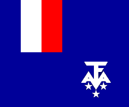
French Austral and Antartic Territories / Terres australes et antartiques françaises / TAAF - flag images of the
Kerguelen islands
(French Austral and Antartic Territories - TAAF - DOM-TOM)
PAGE 1
PAGE 2
Kerguelen island: Golfe du Morbihan - unusual rock formations (photo by Francis Lynch) Kerguelen island: Golfe du Morbihan - unusual rock formations Kerguelen island: Golfe du Morbihan - the coast (photo by Francis Lynch) Kerguelen island: Golfe du Morbihan - the coast
Kerguelen island: one of the islands in Baie Morbihan (photo by Francis Lynch) Kerguelen island: one of the islands in Baie Morbihan Kerguelen island: Baie de l'Oiseau - the stumps of the collapsed Arch of Kerguelen (photo by Francis Lynch) Kerguelen island: Baie de l'Oiseau - the stumps of the collapsed Arch of Kerguelen
Kerguelen island: Fjord des Portes Noires - view of Ampere Plain and Ampere Glacier (photo by Francis Lynch) Kerguelen island: Fjord des Portes Noires - view of Ampere Plain and Ampere Glacier Kerguelen island - TAAF: November - patches of snow remain at the higher elevations - view from the Akademik Shokalskiy (photo by Francis Lynch) Kerguelen island: November - patches of snow remain at the higher elevations - view from the Akademik Shokalskiy
Kerguelen island: Cap Kidder - patch of moss bordered by lichens (photo by Francis Lynch) Kerguelen island: Cap Kidder - patch of moss bordered by lichens Kerguelen island: La Taupinière - 300 days of rain per year (photo by Francis Lynch) Kerguelen island: La Taupinière - 300 days of rain per year
Kerguelen island: Cap de Terres Rouge at the entrance to Baie des Swains (photo by Francis Lynch) Kerguelen island: Cap de Terres Rouges at the entrance to Baie des Swains Kerguelen island: a petrel swoops past a view of a jagged ridge, snowfields, and waterfalls (photo by Francis Lynch) Kerguelen island: a petrel swoops past a view of a jagged ridge, snowfields, and waterfalls
Kerguelen island: a portion of the Massif Gallieni, the most mountainous part of Kerguelen (photo by Francis Lynch) Kerguelen island: a portion of the Massif Gallieni, the most mountainous part of Kerguelen Kerguelen island: the lower coast shows a bit of green (photo by Francis Lynch) Kerguelen island: the lower coast shows a bit of green
Kerguelen island: a rift in the clouds causes the sun to paint a brilliant line across the sea (photo by Francis Lynch) Kerguelen island: a rift in the clouds causes the sun to paint a brilliant line across the sea Kerguelen island: Ilots Joubin (Joubin Islets), near the end of Baie de la Table (photo by Francis Lynch) Kerguelen island: Ilots Joubin near the end of Baie de la Table
Kerguelen island: south coast - La Table mountain (photo by Francis Lynch) Kerguelen island: south coast - La Table mountain Kerguelen island: south coast - a flat rock island lies silhouetted in front of snowy mountains (photo by Francis Lynch) Kerguelen island: south coast - a flat rock island lies silhouetted in front of snowy mountains
PAGE 1
PAGE 2
credits: images © by Francis Lynch
main
image bank /  buy images
previous page (images of the Kergueles islands / photos des Iles Kerguelen)
next country (photos of Kiribati)
 
see also: France, South Orkneys, South Georgia, Falklands, South Shetlands, Crozet, Heard & McDonald, Antarctica, Antarctic region
click on the thumbnails to enlarge the images - 16 photos - Kerguelen Inseln - Bilder - Islas Kerguelen - imágenes
images of the Kerguelen islands / Iles Kerguelen
by
www.travel-images.com