images of Saba (Netherlands Antilles)
Travel-Images.com
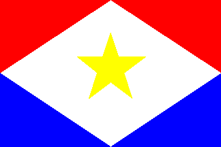
flag of Saba - Eilandgebied Saba (domain of the Netherlands / Holland / Holanda / Países Baixos / Niederland / Nederland / Pays Bas) images of
Saba island
Kingdom of the Netherlands
2 - The Bottom - Saba's Capital
PAGE 1
PAGE 2
page 3
page 4
The Bottom, Saba: Sacred Heart Church - built in 1935 - stone façade - photo by M.Torres The Bottom, Saba: Sacred Heart Church - built in 1935 - stone façade The Bottom, Saba: Sacred Heart Church - red gate - photo by M.Torres The Bottom, Saba: Sacred Heart Church - red gate


The Bottom, Saba: Sacred Heart Church - window - photo by M.Torres The Bottom, Saba: Sacred Heart Church - window The Bottom, Saba: red roofs, cross and the mountains above the town - photo by M.Torres The Bottom, Saba: red roofs, cross and the mountains above the town
The Bottom, Saba: Sacred Heart Church - angels play - fresco by Heleen Cornet above the altar - Saba's Sistine Chapel - photo by M.Torres The Bottom, Saba: Sacred Heart Church - angels play - fresco by Heleen Cornet above the altar - Saba's Sistine Chapel The Bottom, Saba: Plumeria flowers - Frangipani - photo by M.Torres The Bottom, Saba: Plumeria flowers - Frangipani
The Bottom, Saba: main entrance of the Regional Service Center - photo by M.Torres The Bottom, Saba: main entrance of the Regional Service Center The Bottom, Saba: Saba Culture Building - wooden façade of a gingerbread house - photo by M.Torres The Bottom, Saba: Saba Culture Building - wooden façade of a gingerbread house
The Bottom, Saba: Saba's flag flying at the Regional Service Center - photo by M.Torres The Bottom, Saba: Saba's flag flying at the Regional Service Center The Bottom, Saba: wooden cottage on Captain Randolph Dunkin Street - photo by M.Torres The Bottom, Saba: wooden cottage on Captain Randolph Dunkin Street
The Bottom, Saba: the the largest settlement on the island - general view of the town, at the bottom of neighbouring hills, its orginal Dutch name was De Botte, meaning 'The Bowl' - photo by M.Torres The Bottom, Saba: the the largest settlement on the island - general view of the town, at the bottom of neighbouring hills, its orginal Dutch name was De Botte, meaning 'The Bowl' The Bottom, Saba: town center seen from the road to St. John's - photo by M.Torres The Bottom, Saba: town center seen from the road to St. John's
The Bottom, Saba: Saba University School of Medicine - the campus seen seen from above - red roofs and forest - photo by M.Torres The Bottom, Saba: Saba University School of Medicine - the campus seen seen from above - red roofs and forest The Bottom, Saba: Dutch colonial architecture - Department of Public Works, a former schoolhouse  - picket fence - photo by M.Torres The Bottom, Saba: Dutch colonial architecture - Department of Public Works, a former schoolhouse - picket fence
The Bottom, Saba: Sacred Heart Church and winding road ahead sign, alerting for the dangers of Josephus Lambert Hassell's 'The Road' - photo by M.Torres The Bottom, Saba: Sacred Heart Church and winding road ahead sign, alerting for the dangers of Josephus Lambert Hassell's 'The Road' The Bottom, Saba: Sacred Heart Church - small windows on a stone wall - photo by M.Torres The Bottom, Saba: Sacred Heart Church - small windows on a stone wall
PAGE 1
PAGE 2
page 3
page 4
buy images
main
credits: all photos © by M.Torres / Travel-Images.com
previous page (photos of Saba)
next page (photos of Saba)
see also: Curaçao, Sint Maarten, Anguilla, St Barts, Puerto Rico, US Virgin Islands, British Virgin Islands, Aruba, St Barts, Cuba, Jamaica, Netherlands, Americas, Caribbean
click on the thumbnails to enlarge the images - photos - Saba image bank
images of Saba - BES islands - WOLBES - formerly part of the Netherlands Antilles
by
www.travel-images.com