 The
Russian republic of Dagestan is home to a sizeable Azeri community, numbering
about 80.000 people. They are mainly in the Derbent district ('rayon'),
about 125 kms southeast of Dagestan's capital Makhachkala with a lot also
living in the Tabasaransk district.
The
Russian republic of Dagestan is home to a sizeable Azeri community, numbering
about 80.000 people. They are mainly in the Derbent district ('rayon'),
about 125 kms southeast of Dagestan's capital Makhachkala with a lot also
living in the Tabasaransk district.
Derbent is the southernmost city in the Russian Federation, and it is the second most important city of Dagestan, with a population of over 90.000, the Azeris are the main ethnic group, followed by Lezgin and Tabasaran. (To avoid confusion, please note that there is another town called Derbent, located in the southern part of Uzbekistan, Surkhondaryo province).
 The
city is built near the western shores of the Caspian sea, south of the
river Rubas, on the slopes of the Tabasaran mountains (part of the Bigger
Caucasus range). Derbent is well served by transportation, with its own
harbour, a railway going south to Baku and the Baku to Rostov-on-Don road.
The
city is built near the western shores of the Caspian sea, south of the
river Rubas, on the slopes of the Tabasaran mountains (part of the Bigger
Caucasus range). Derbent is well served by transportation, with its own
harbour, a railway going south to Baku and the Baku to Rostov-on-Don road.
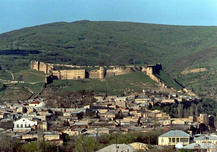
Derbent has a unique strategical location in the Caucasus: the city is situated on a thin strip of land (3km) between the Caspian sea and the Caucasus mountains, controlling land traffic between south-eastern Europe and the Middle east.
 Derbent
claims to be the oldest city in the Russian Federation. Since antiquity
the value of the area as the gate to the Caucasus has been understood and
Derbent has archaeological structures over 5000 years old. As a result
of this geographic particularity the city developed between two walls,
stretching from the mountains till the sea. Along the times different nations
gave the city different names, but all connected to the word 'gate'.
Derbent
claims to be the oldest city in the Russian Federation. Since antiquity
the value of the area as the gate to the Caucasus has been understood and
Derbent has archaeological structures over 5000 years old. As a result
of this geographic particularity the city developed between two walls,
stretching from the mountains till the sea. Along the times different nations
gave the city different names, but all connected to the word 'gate'.
The first intensive settlement in the Derbent area dates from the 8th century B.C. Until the 4th century A.D. century it was part of Caucasian Albania, when it became part of the Sassanid empire as a strong military outpost and harbour. During the 5th and 6th centuries Derbent becomes also an important centre for spreading the Christian faith in the Caucasus.
 During
the 630s it was invaded by the Khazar khanate. In 654 Derbent was captured
by the Arabs, which transformed it in an important administrative centre
and introduced Islam to the area. In the 10th century, with the collapse
of the Arab Caliphate Derbent becomes an emirate, until it's invaded by
the Mongols in 1239.
During
the 630s it was invaded by the Khazar khanate. In 654 Derbent was captured
by the Arabs, which transformed it in an important administrative centre
and introduced Islam to the area. In the 10th century, with the collapse
of the Arab Caliphate Derbent becomes an emirate, until it's invaded by
the Mongols in 1239.
In the 14th century it was occupied by the hordes of the Tatar warlord Timur. In 1437 it falls under the control of the Shirvan Khan. During the 16th century Derbent is the arena for wars between Turkey and Persia ruled by the Azeri Sefevid dynasty. By the early 17th century the Sefevid Shah Abbas inflicted a serious defeat on the Turks and recoverd Derbent.
By the 1735 Ganja treaty Derbent falls within the Persian state. In 1747 Derbent became the capital of the khanate of the same name. Finally in 1796 it was occupied by Russian forces involved in the 2nd Persian campaign. As a consequence of the Gulistan treaty of 1813 - between Russian and Persia - Derbent became part of the Russian empire.
 A
large portion of the walls and several watchtowers have been preserved
in reasonable shape till our days. The walls, reaching until the sea,
date from the 6th century, Sassanid dynasty period. The city has a well
preserved citadel (Narin-kala), comprising an area of 4.5 hectares, enclosed
by strong walls. It's worth visiting the baths, the cisterns,
the old cemeteries, the caravanserai, the 18th century Khan's mausoleum,
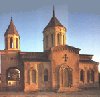
the Armenian Church as well as several mosques: the most interesting
built from a 6th century Christian basilica is the Juma Mosque (with a
15th century madrassa); the 17th century Kyrhlyar mosque, the Bala mosque
and the 18th century Chertebe mosque.
A
large portion of the walls and several watchtowers have been preserved
in reasonable shape till our days. The walls, reaching until the sea,
date from the 6th century, Sassanid dynasty period. The city has a well
preserved citadel (Narin-kala), comprising an area of 4.5 hectares, enclosed
by strong walls. It's worth visiting the baths, the cisterns,
the old cemeteries, the caravanserai, the 18th century Khan's mausoleum,
the Armenian Church as well as several mosques: the most interesting
built from a 6th century Christian basilica is the Juma Mosque (with a
15th century madrassa); the 17th century Kyrhlyar mosque, the Bala mosque
and the 18th century Chertebe mosque.
 The
city is home to machine building, food (even a brewery and wineries!),
textile, fishing and fishery supplies, construction materials and wood
industries.
The
city is home to machine building, food (even a brewery and wineries!),
textile, fishing and fishery supplies, construction materials and wood
industries.
The education infrastructure is quite good, there is a university as well as several technical schools. On the cultural front, don't miss the Lezgin drama theatre (known as the S.Stalsky theatre). There a nice vacation colony about 2km from the city ('Chayka' - Seagull).
Derbent being in practice a huge museum and with magnificent mountains and shore nearby, a great potential for development of the tourism industry exists, further increased by UNESCO's classification of the Citadel, Ancient City and Fortress as 'world heritage' in 2003, however instability in the region hasn't allowed further development (Russian visa procedures are also not very helpful).
If you plan to travel to Derbent probably you will require a Russian visa. There are trains to Baku and a consulate of Azerbaijan is expected to open in the near future.
(230 km northeast of Baku)

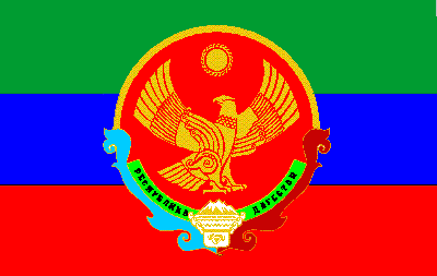
 With
a Caspian coast line of about 400 kms, Dagestan is divided into 42 districts,
10 cities and 14 urban settlements. The capital is Makhachkala, ex-Petrovsk-Port.
It borders Azerbaijan and Georgia and inside the Russian Federation Chechnia,
Kalmykia and the Stavropol region. The main rivers are the Terek, the Sulak
and the Samur.
With
a Caspian coast line of about 400 kms, Dagestan is divided into 42 districts,
10 cities and 14 urban settlements. The capital is Makhachkala, ex-Petrovsk-Port.
It borders Azerbaijan and Georgia and inside the Russian Federation Chechnia,
Kalmykia and the Stavropol region. The main rivers are the Terek, the Sulak
and the Samur.